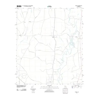
2011 Map of Howell
USGS Topo · Published 2011About this map
The Alapaha River meanders through the eastern portion of this landscape, its path joined by numerous tributaries including Howell Branch and Connell Branch. This agricultural and timber-producing region of Echols County is anchored by the small settlements of Howell and Mayday in the east, with Blanton situated further west. The map reveals a network of rural roads such as Old Statenville Rd and Camp Langdale Rd that connect family holdings and community centers. For those documenting local genealogy, several significant sites are preserved on this record, including the Unity Cemetery, Wetherington Cemetery, and Carter Cemetery near Martin Branch. The presence of Unity Church in the northwest corner suggests the longstanding social centers of this rural community, while the drainage patterns of Grand Bay Creek and Meetinghouse Branch define the low-lying terrain character of south Georgia.
Find a feature on this map
51 named features on this map. Tap any name to fly to it.
Don’t see what you’re looking for? This feature index may not catch every label — zoom into the map to look around manually.
Map Details
Editions of this 2011 Howell Map
This is the sole edition of this map. No revisions or reprints were ever made.
Other maps of this area

1954 · Valdosta
USGS Topo · 1:250,000

1958 · Valdosta
USGS Topo · 1:250,000

1959 · Valdosta
USGS Topo · 1:250,000

1968 · Naylor
USGS Topo · 1:24,000

1971 · Indianola
USGS Topo · 1:24,000

1971 · Howell
USGS Topo · 1:24,000

1971 · Lake Park
USGS Topo · 1:24,000

1971 · Stockton
USGS Topo · 1:24,000

1971 · Tarver
USGS Topo · 1:24,000
1971 · Bemiss
USGS Topo · 1:24,000