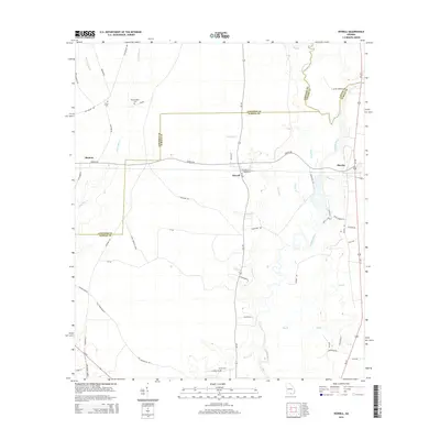
2014 Map of Howell
USGS Topo · Published 2014About this map
The Alapaha River forms a winding corridor through this section of southern Georgia, defining much of the border between Lanier and Echols counties. This 2014 survey documents a rural landscape where the small settlements of Howell and Mayday serve as local hubs for a network of county roads including Valentine Rd and Howell Rd. The terrain is deeply influenced by slow-moving water, with numerous tributaries such as Pindar Cr and Rentz Br feeding into the river system. Family and community heritage is grounded in several rural burial grounds, including Unity Cem, Wetherington Cem, and Carter Cem, which provide essential points of reference for genealogists. The map also highlights the transition from Lowndes to Echols County, capturing the enduring rural character of the region near the Florida border.
Find a feature on this map
56 named features on this map. Tap any name to fly to it.
Don’t see what you’re looking for? This feature index may not catch every label — zoom into the map to look around manually.
Map Details
Editions of this 2014 Howell Map
This is the sole edition of this map. No revisions or reprints were ever made.
Other maps of this area

1954 · Valdosta
USGS Topo · 1:250,000

1958 · Valdosta
USGS Topo · 1:250,000

1959 · Valdosta
USGS Topo · 1:250,000

1968 · Naylor
USGS Topo · 1:24,000

1971 · Indianola
USGS Topo · 1:24,000

1971 · Howell
USGS Topo · 1:24,000

1971 · Lake Park
USGS Topo · 1:24,000

1971 · Stockton
USGS Topo · 1:24,000

1971 · Tarver
USGS Topo · 1:24,000
1971 · Bemiss
USGS Topo · 1:24,000