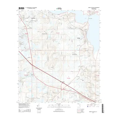
2015 Map of Howey-in-the-Hills
USGS Topo · Published 2015About this map
Lake Harris dominates the northeastern corner of this Lake County landscape, serving as a primary water body in a region defined by its dense network of lakes and ponds. The settlement of Howey-in-the-Hills occupies the shore of Lake Illinois, while the city of Groveland anchors the southern portion of the map along the Florida Turnpike and SR 19. The terrain is characterized by numerous enclosed basins, including Turkey Lake, Mulehead Lake, and Pumpkin Center Lake, which sit between low-lying rises like Booths Island.
Find a feature on this map
170 named features on this map. Tap any name to fly to it.
Don’t see what you’re looking for? This feature index may not catch every label — zoom into the map to look around manually.
Map Details
Editions of this 2015 Howey-in-the-Hills Map
This is the sole edition of this map. No revisions or reprints were ever made.
Other maps of this area

1955 · Orlando
USGS Topo · 1:250,000

1957 · Orlando
USGS Topo · 1:250,000

1958 · Orlando
USGS Topo · 1:250,000

1962 · Orlando
USGS Topo · 1:250,000

1962 · Clermont East
USGS Topo · 1:24,000

1962 · Astatula
USGS Topo · 1:24,000

1965 · Leesburg East
USGS Topo · 1:24,000

1966 · Leesburg West
USGS Topo · 1:24,000
1966 · Eustis
USGS Topo · 1:24,000
1969 · Center Hill
USGS Topo · 1:24,000