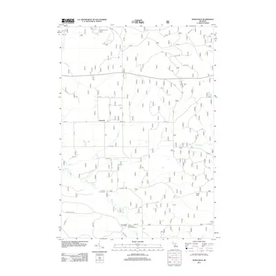
2012 Map of Hoxeyville
USGS Topo · Published 2012About this map
The Pine River winds through the southern portion of this landscape, serving as a focal point for recreation at the Lincoln Bridge State Forest Campground and the Elm Flats Canoe Access. The area is characterized by a mix of forestry and established rural features, centered on the small settlement of Hoxeyville with its Po and the nearby Banker Cem. To the north, the terrain shifts towards leisure and elevation at the Caberfae Peaks Ski and Golf Resort, while the Kellogg Lookout Tower stands as a sentinel over the eastern woodlands. A network of creeks, including Poplar Cr and Dowling Cr, drain the interior, reflecting a region deeply tied to its watercourses and seasonal tourism. This 2012 survey illustrates the modern configuration of forest service roads and local routes that define access to these Michigan highlands.
Find a feature on this map
42 named features on this map. Tap any name to fly to it.
Don’t see what you’re looking for? This feature index may not catch every label — zoom into the map to look around manually.
Map Details
Editions of this 2012 Hoxeyville Map
This is the sole edition of this map. No revisions or reprints were ever made.
Other maps of this area

1933 · Peacock SE
USGS Topo · 1:31,680

1933 · Luther SE
USGS Topo · 1:31,680

1933 · Peacock NE
USGS Topo · 1:31,680

1933 · Luther SW
USGS Topo · 1:31,680

1933 · Luther NW
USGS Topo · 1:31,680

1954 · Traverse City
USGS Topo · 1:250,000

1956 · Mesick
USGS Topo · 1:62,500

1957 · Copemish
USGS Topo · 1:62,500

1957 · Luther
USGS Topo · 1:62,500

1957 · Wellston
USGS Topo · 1:62,500