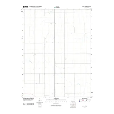
2009 Map of Hoxie NW
USGS Topo · Published 2009About this map
Immanuel Cemetery stands as a focal point for genealogical interest in this rural Sheridan County landscape, where the high plains are carved by several significant waterways. The North Fork Solomon River crosses the northern edge of the terrain, while Bow Creek and its tributary, South Bow Creek, meander through the central and southern portions. The map illustrates a disciplined grid of section lines and local transit routes, including Co RD 380, reflecting the organized agricultural development typical of western Kansas. Scattered farmsteads and individual structures are documented across this expanse, offering a precise view of rural land use and homestead placement in the early twenty-first century.
Find a feature on this map
5 named features on this map. Tap any name to fly to it.
Don’t see what you’re looking for? This feature index may not catch every label — zoom into the map to look around manually.
Map Details
Editions of this 2009 Hoxie NW Map
This is the sole edition of this map. No revisions or reprints were ever made.
Other maps of this area

1951 · Selden
USGS Topo · 1:62,500

1954 · Goodland
USGS Topo · 1:250,000

1956 · Goodland
USGS Topo · 1:250,000

1957 · Goodland
USGS Topo · 1:250,000

1978 · Allison
USGS Topo · 1:24,000

1978 · Selden
USGS Topo · 1:24,000

1978 · Dresden South
USGS Topo · 1:24,000

1979 · Hoxie
USGS Topo · 1:24,000

1979 · Hoxie NE
USGS Topo · 1:24,000
1979 · Rexford NE
USGS Topo · 1:24,000