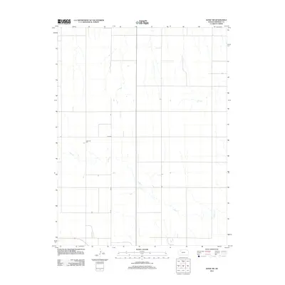
2012 Map of Hoxie NW
USGS Topo · Published 2012About this map
Sheridan County agricultural patterns and the headwaters of the Solomon River basin define this landscape in Northwest Kansas. The terrain is characterized by the meandering courses of S Bow Cr and Bow Cr, which cut through the high plains topography. Human presence is marked by the rectilinear grid of rural roads, including Co RD 380, which facilitate movement between scattered farmsteads. A significant local landmark for genealogists and historians is the Immanuel Cem, located in the western portion of the quadrangle. This site serves as a primary record of the early families who settled this part of the Kansas prairie, representing the community's enduring legacy in a region where the vast majority of the land remains dedicated to large-scale cultivation.
Find a feature on this map
4 named features on this map. Tap any name to fly to it.
Don’t see what you’re looking for? This feature index may not catch every label — zoom into the map to look around manually.
Map Details
Editions of this 2012 Hoxie NW Map
This is the sole edition of this map. No revisions or reprints were ever made.
Other maps of this area

1951 · Selden
USGS Topo · 1:62,500

1954 · Goodland
USGS Topo · 1:250,000

1956 · Goodland
USGS Topo · 1:250,000

1957 · Goodland
USGS Topo · 1:250,000

1978 · Allison
USGS Topo · 1:24,000

1978 · Selden
USGS Topo · 1:24,000

1978 · Dresden South
USGS Topo · 1:24,000

1979 · Hoxie
USGS Topo · 1:24,000

1979 · Hoxie NE
USGS Topo · 1:24,000
1979 · Rexford NE
USGS Topo · 1:24,000