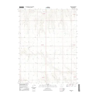
2015 Map of Hoxie NW
USGS Topo · Published 2015About this map
Immanuel Cem stands as a quiet focal point in the northwestern corner of Sheridan County, serving the rural families of this high plains agricultural landscape. The terrain is defined by the ephemeral drainages of Bow Creek and its southern branch, S Bow Creek, which carve gentle coulees through the section lines. This 2015 digital survey by the U.S. Geological Survey reveals a strictly organized grid of section roads, including Co Rd 380 and numerous numbered routes like Rd 100 N and Rd 30 W. The map documents the enduring township and range system, showing the boundaries between t7s r28w and surrounding townships, where the land remains dedicated to large-scale dryland farming and ranching.
Find a feature on this map
34 named features on this map. Tap any name to fly to it.
Don’t see what you’re looking for? This feature index may not catch every label — zoom into the map to look around manually.
Map Details
Editions of this 2015 Hoxie NW Map
This is the sole edition of this map. No revisions or reprints were ever made.
Other maps of this area

1951 · Selden
USGS Topo · 1:62,500

1954 · Goodland
USGS Topo · 1:250,000

1956 · Goodland
USGS Topo · 1:250,000

1957 · Goodland
USGS Topo · 1:250,000

1978 · Allison
USGS Topo · 1:24,000

1978 · Selden
USGS Topo · 1:24,000

1978 · Dresden South
USGS Topo · 1:24,000

1979 · Hoxie
USGS Topo · 1:24,000

1979 · Hoxie NE
USGS Topo · 1:24,000
1979 · Rexford NE
USGS Topo · 1:24,000