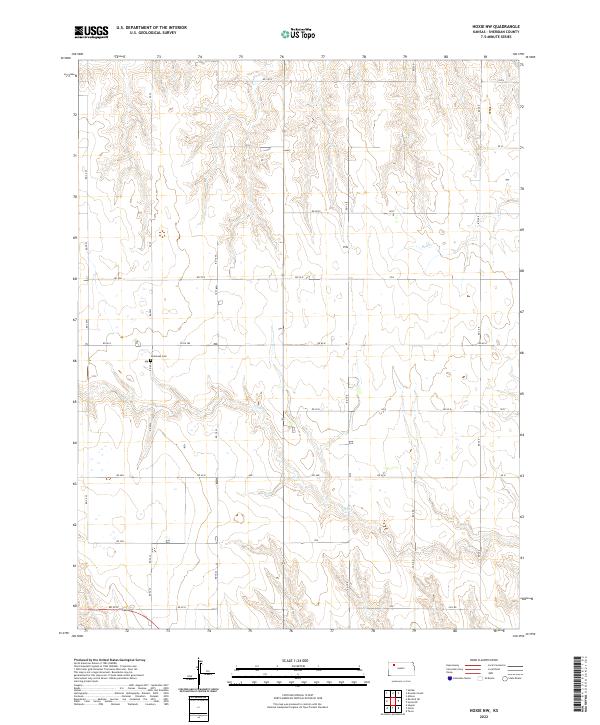
2022 Map of Hoxie NW
USGS Topo · Published 2022About this map
Immanuel Cem serves as a primary local landmark in this part of Sheridan County, situated in a landscape defined by the drainage of Bow Creek and its southern branch, S Bow Cr. The map reveals a highly structured agricultural grid, where a network of section roads like RD 100 N and RD 70 N divide the prairie into uniform parcels. This pattern reflects the enduring legacy of the Public Land Survey System in western Kansas, showing how rural development followed the rigid geometry of the township and range lines. The subtle relief of the terrain is primarily marked by the winding paths of the creek beds, which provided the only natural breaks in an otherwise strictly partitioned territory.
Find a feature on this map
30 named features on this map. Tap any name to fly to it.
Don’t see what you’re looking for? This feature index may not catch every label — zoom into the map to look around manually.
Map Details
Editions of this 2022 Hoxie NW Map
This is the sole edition of this map. No revisions or reprints were ever made.
Other maps of this area

1951 · Selden
USGS Topo · 1:62,500

1954 · Goodland
USGS Topo · 1:250,000

1956 · Goodland
USGS Topo · 1:250,000

1957 · Goodland
USGS Topo · 1:250,000

1978 · Allison
USGS Topo · 1:24,000

1978 · Selden
USGS Topo · 1:24,000

1978 · Dresden South
USGS Topo · 1:24,000

1979 · Hoxie
USGS Topo · 1:24,000

1979 · Hoxie NE
USGS Topo · 1:24,000
1979 · Rexford NE
USGS Topo · 1:24,000