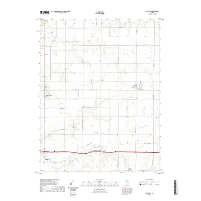
2021 Map of Hoyleton
USGS Topo · Published 2021About this map
Nashville and its surrounding rural townships in Washington County are defined by a grid of agricultural section lines and small community centers. This modern landscape retains the clear fingerprints of early German Lutheran settlement patterns, particularly evident in the cluster of church-related sites like Saint Johns Cem near New Minden and the Trinity Cem in Hoyleton. The terrain is gently shaped by the drainage of Coon Creek to the north and the upper reaches of Middle Creek to the south.
Find a feature on this map
40 named features on this map. Tap any name to fly to it.
Don’t see what you’re looking for? This feature index may not catch every label — zoom into the map to look around manually.
Map Details
Editions of this 2021 Hoyleton Map
This is the sole edition of this map. No revisions or reprints were ever made.
Other maps of this area

1910 · Carlyle
USGS Topo · 1:62,500

1914 · Centralia
USGS Topo · 1:62,500

1931 · Hoyleton
USGS Topo · 1:48,000

1932 · Nashville
USGS Topo · 1:62,500

1935 · Centralia
USGS Topo · 1:62,500

1936 · Nashville
USGS Topo · 1:62,500

1943 · Ashley
USGS Topo · 1:62,500

1946 · Ashley
USGS Topo · 1:62,500

1948 · Carlyle
USGS Topo · 1:62,500

1958 · Belleville
USGS Topo · 1:250,000