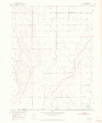
1950 Map of Hoyt
USGS Topo · Published 1972About this map
Hoyt and its surrounding high plains landscape are defined by the winding course of Bijou Creek as it was mapped at mid-century. This region on the Morgan and Adams County line reflects a ranching and utility-focused economy, anchored by the Hoyt Cemetery and the Long Meadow Community Center. The presence of specialized infrastructure, including the USGS Testing and Recording Station and the USBR Substation, suggests the importance of water management and technical monitoring in this arid environment. The terrain is marked by seasonal drainage patterns from Antelope Creek and Rock Creek, which converge toward the larger floodplains. Genealogists and local historians can trace the early road network and the positioning of prominent landforms like Bidwell Hill and the waters of Moore Reservoir No 4, which were vital to the settlement's survival in the Missouri River Basin.
Find a feature on this map
16 named features on this map. Tap any name to fly to it.
Don’t see what you’re looking for? This feature index may not catch every label — zoom into the map to look around manually.
Map Details
Editions of this 1950 Hoyt Map
4 editions found
Other maps of this area

1950 · Wiggins
USGS Topo · 1:24,000

1950 · Wiggins SW
USGS Topo · 1:24,000

1950 · Hoyt
USGS Topo · 1:24,000

1951 · Hoyt
USGS Topo · 1:24,000

1951 · Leader NW
USGS Topo · 1:24,000

1951 · Omar
USGS Topo · 1:24,000

1951 · Leader
USGS Topo · 1:24,000

1953 · Denver
USGS Topo · 1:250,000

1954 · Limon
USGS Topo · 1:250,000

1954 · Sterling
USGS Topo · 1:250,000