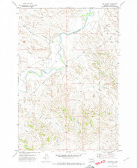
1971 Map of HS School
USGS Topo · Published 1974About this map
The Tongue River meanders through the central portion of this 1971 survey in Custer County, Montana, carving a distinct valley through the surrounding hills. This landscape is defined by its drainages and isolated rural infrastructure, most notably the H S School situated in the northern half of the quadrangle. The map captures a ranching environment where Ranch Road and various Jeep Trails provide the primary access to remote sections of the land.
Find a feature on this map
14 named features on this map. Tap any name to fly to it.
Don’t see what you’re looking for? This feature index may not catch every label — zoom into the map to look around manually.
Map Details
Editions of this 1971 HS School Map
This is the sole edition of this map. No revisions or reprints were ever made.
Other maps of this area

1953 · Miles City
USGS Topo · 1:250,000

1954 · Hardin
USGS Topo · 1:250,000

1954 · Ekalaka
USGS Topo · 1:250,000

1954 · Forsyth
USGS Topo · 1:250,000

1956 · Ekalaka
USGS Topo · 1:250,000

1957 · Miles City
USGS Topo · 1:250,000

1957 · Hardin
USGS Topo · 1:250,000

1957 · Forsyth
USGS Topo · 1:250,000

1958 · Miles City
USGS Topo · 1:250,000

1958 · Ekalaka
USGS Topo · 1:250,000