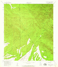
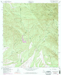
1958 Map of Huachuca Peak
USGS Topo · Published 1959About this map
Coronado National Forest dominates this high-elevation landscape in the late 1950s, where the rugged topography of the Huachuca Mountains meets the headwaters of numerous drainages. The map reveals a remote ranching and mining economy defined by isolated outposts such as Tom Wills Camp, Joiner Camp, and the Sunnyside Ranch. At the heart of the region lies the settlement of Sunnyside, nearby the Sunnyside Cemetery and the Eureka Mine, indicating a small but established community centered around the mineral wealth and grazing lands of the canyons.
Find a feature on this map
52 named features on this map. Tap any name to fly to it.
Don’t see what you’re looking for? This feature index may not catch every label — zoom into the map to look around manually.
Map Details
Editions of this 1958 Huachuca Peak Map
5 editions found
Other maps of this area

1904 · Patagonia
USGS Topo · 1:125,000

1905 · Patagonia
USGS Topo · 1:125,000

1905 · Nogales
USGS Topo · 1:125,000

1914 · Hereford
USGS Topo · 1:125,000

1915 · Benson
USGS Topo · 1:125,000

1922 · Sunnyside
USGS Topo · 1:62,500

1932 · Lochiel
USGS Topo · 1:62,500

1932 · Elgin
USGS Topo · 1:62,500

1938 · Huachuca
USGS Topo · 1:62,500

1938 · Sunnyside
USGS Topo · 1:62,500