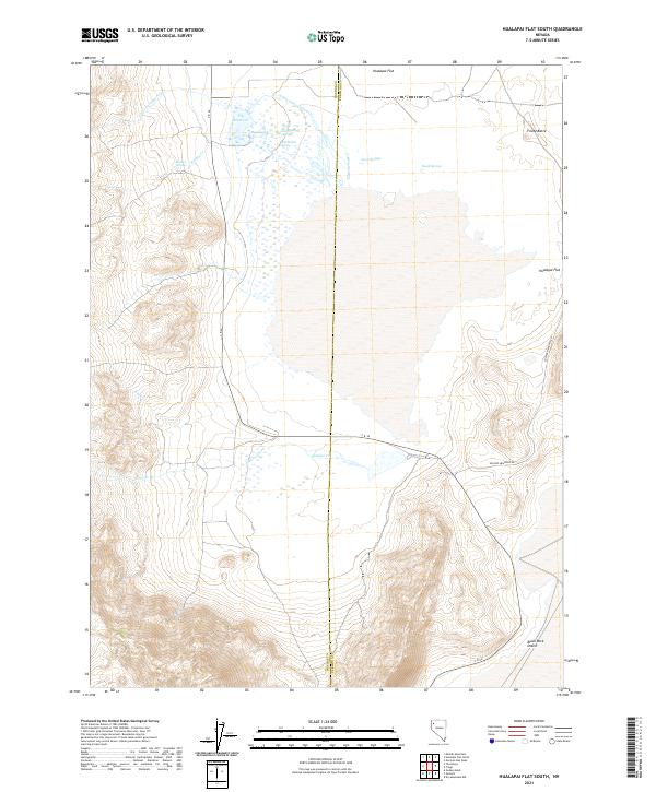
2021 Map of Hualapai Flat South
USGS Topo · Published 2021About this map
Hualapai Flat defines the center of this high-desert landscape at the intersection of Washoe and Pershing counties. The arid basin is punctuated by unique geothermal and hydrological features, notably the Fly Reservoir and The Geyser, along with numerous thermal outlets like Wards Hot Spring. These water sources are critical landmarks in a region defined by seasonal drainages such as Granite Creek and Little Cottonwood Cr.
Find a feature on this map
26 named features on this map. Tap any name to fly to it.
Don’t see what you’re looking for? This feature index may not catch every label — zoom into the map to look around manually.
Map Details
Editions of this 2021 Hualapai Flat South Map
This is the sole edition of this map. No revisions or reprints were ever made.
Other maps of this area

1886 · Granite Range
USGS Topo · 1:250,000

1894 · Granite Range
USGS Topo · 1:250,000

1955 · Lovelock
USGS Topo · 1:250,000

1959 · Lovelock
USGS Topo · 1:250,000

1964 · Gerlach
USGS Topo · 1:62,500

1980 · Dry Mountain NW
USGS Topo · 1:24,000

1980 · Melody Mountain
USGS Topo · 1:24,000
1980 · The Banjo
USGS Topo · 1:24,000
1980 · Hualapai Flat North
USGS Topo · 1:24,000
1980 · Mormon Dan Peak
USGS Topo · 1:24,000