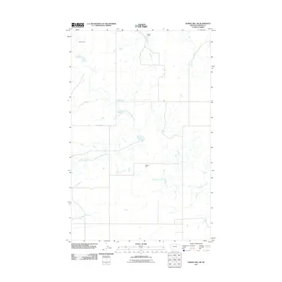
2011 Map of Hubert Hill SW
USGS Topo · Published 2011About this map
Assiniboine Creek meanders through this section of Phillips County, carving a network of drainage channels across a landscape defined by seasonal water management. The mapping reveals a series of small-scale earthen structures including Plethora Dam, Matulka Dam, and Boothe Dam, which reflect the local necessity of water storage in this arid northern Montana environment. The drainage pattern of the North Fork Dodson Creek dominates the upper half of the quadrangle, intersecting with N Dodson Rd. This area is characterized by large, open sections and minimal infrastructure, primarily composed of section-line roads and drainage basins that support the region's ranching or agricultural operations.
Find a feature on this map
7 named features on this map. Tap any name to fly to it.
Don’t see what you’re looking for? This feature index may not catch every label — zoom into the map to look around manually.
Map Details
Editions of this 2011 Hubert Hill SW Map
This is the sole edition of this map. No revisions or reprints were ever made.
Other maps of this area

1920 · Avery
USGS Topo · 1:125,000

1953 · Havre
USGS Topo · 1:250,000

1957 · Havre
USGS Topo · 1:250,000

1958 · Havre
USGS Topo · 1:250,000

1964 · Dodson NE
USGS Topo · 1:24,000

1964 · Dodson
USGS Topo · 1:24,000

1964 · Dodson Dam
USGS Topo · 1:24,000

1984 · Emerick Bench
USGS Topo · 1:24,000
1984 · Hubert Hill SW
USGS Topo · 1:24,000
1984 · Down Reservoir NE
USGS Topo · 1:24,000