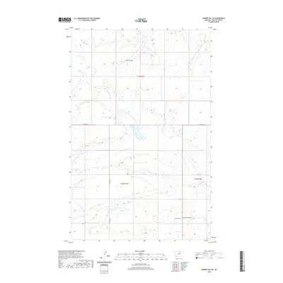
2020 Map of Hubert Hill SW
USGS Topo · Published 2020About this map
The drainage patterns of the northern Montana plains define this landscape in Phillips County. The hydrology is dominated by the North Fork Dodson Creek, which winds through the central portion of the quadrangle alongside its smaller tributary, N Fork Dodson Cr. To the north, Joiner Coulee cuts through the terrain, while Assiniboine Cr flows through the southeastern sections. The map reveals a systematic grid of section lines and rural transport routes that support the local ranching and agricultural economy. Key access points include N Dodson Rd, Williamson Rd, and Mortensen Rd, providing a framework for understanding land use and property boundaries in this remote part of the state.
Find a feature on this map
11 named features on this map. Tap any name to fly to it.
Don’t see what you’re looking for? This feature index may not catch every label — zoom into the map to look around manually.
Map Details
Editions of this 2020 Hubert Hill SW Map
This is the sole edition of this map. No revisions or reprints were ever made.
Other maps of this area

1920 · Avery
USGS Topo · 1:125,000

1953 · Havre
USGS Topo · 1:250,000

1957 · Havre
USGS Topo · 1:250,000

1958 · Havre
USGS Topo · 1:250,000

1964 · Dodson NE
USGS Topo · 1:24,000

1964 · Dodson
USGS Topo · 1:24,000

1964 · Dodson Dam
USGS Topo · 1:24,000

1984 · Emerick Bench
USGS Topo · 1:24,000
1984 · Hubert Hill SW
USGS Topo · 1:24,000
1984 · Down Reservoir NE
USGS Topo · 1:24,000