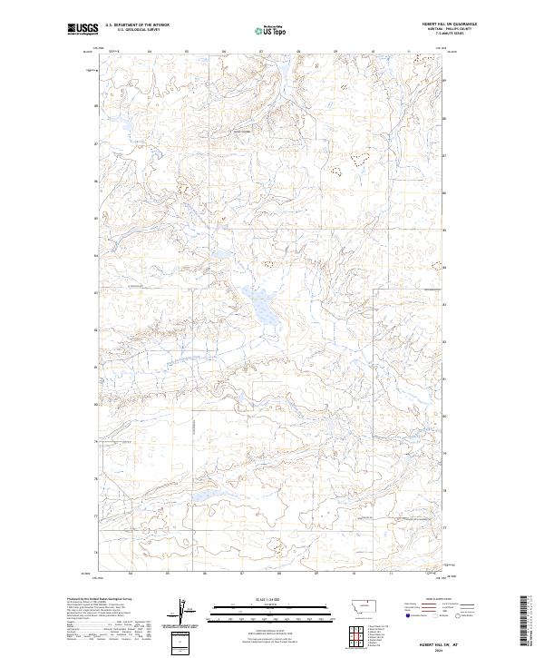
2024 Map of Hubert Hill SW
USGS Topo · Published 2024About this map
North Fork Dodson Creek meanders through this section of Phillips County, shaping a drainage pattern that defines the rural ranching and agricultural landscape. The terrain is marked by the distinct draws of Joiner Coulee and Assiniboine Creek, which cut through the open plains characteristic of this part of Montana. This survey provides a precise look at the township and range divisions, specifically within t33n r27e, t32n r27e, and t32n r28e, illustrating how property was partitioned across the prairie. Local transit is confined to established section-line routes such as N Dodson Rd, Williamson Rd, and Mortensen Rd. The presence of Northsen Rd N Wagner in the southeast corner suggests local connections to the neighboring Wagner area, offering a clear record of the modern road network and water distribution in this northern Montana reach.
Find a feature on this map
10 named features on this map. Tap any name to fly to it.
Don’t see what you’re looking for? This feature index may not catch every label — zoom into the map to look around manually.
Map Details
Editions of this 2024 Hubert Hill SW Map
This is the sole edition of this map. No revisions or reprints were ever made.
Other maps of this area

1920 · Avery
USGS Topo · 1:125,000

1953 · Havre
USGS Topo · 1:250,000

1957 · Havre
USGS Topo · 1:250,000

1958 · Havre
USGS Topo · 1:250,000

1964 · Dodson NE
USGS Topo · 1:24,000

1964 · Dodson
USGS Topo · 1:24,000

1964 · Dodson Dam
USGS Topo · 1:24,000

1984 · Emerick Bench
USGS Topo · 1:24,000
1984 · Hubert Hill SW
USGS Topo · 1:24,000
1984 · Down Reservoir NE
USGS Topo · 1:24,000