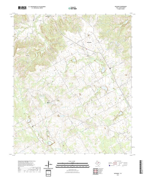
2022 Map of Huckabay
USGS Topo · Published 2022About this map
Huckabay and Hannibal anchor this rural Erath County landscape, which is defined by the branching tributaries of the North Bosque and Paluxy rivers. The terrain shifts from the prominent Blue Hills in the west to the deeply carved Wood Hollow and Council Br further south. This modern survey reveals a community deeply connected to its agricultural roots and lineage, evidenced by a high density of family-named cemeteries and dairy operations. Genealogists will find notable value in the distribution of burial sites including Hannibal Cem, Huckabay Cem, Everett Cem, and the Shelby Cem near the S Fork N Bosque River. The map also details local water management through features like the Mount Pleasant Dairy Pond and Scarborough Cr, reflecting the region's long-standing reliance on its river forks and local creeks.
Find a feature on this map
63 named features on this map. Tap any name to fly to it.
Don’t see what you’re looking for? This feature index may not catch every label — zoom into the map to look around manually.
Map Details
Editions of this 2022 Huckabay Map
This is the sole edition of this map. No revisions or reprints were ever made.
Other maps of this area

1890 · Stephenville
USGS Topo · 1:125,000

1920 · Stephenville
USGS Topo · 1:125,000

1954 · Abilene
USGS Topo · 1:250,000

1958 · Abilene
USGS Topo · 1:250,000

1961 · Knob Hill
USGS Topo · 1:24,000

1961 · Stephenville
USGS Topo · 1:24,000

1965 · Huckabay SW
USGS Topo · 1:24,000

1965 · Lingleville
USGS Topo · 1:24,000
1965 · Bunyan
USGS Topo · 1:24,000
1965 · Reddy Mountain
USGS Topo · 1:24,000