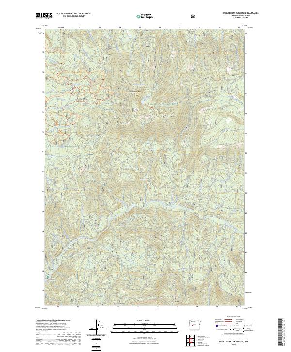
2024 Map of Huckleberry Mountain
USGS Topo · Published 2024About this map
Huckleberry Mountain serves as a central landmark for this high-elevation reach of the Willamette National Forest, where a complex network of seasonal drainages shapes the steep landscape. The area is defined by its recreational infrastructure, particularly the Huckleberry Flats Atv #100 Trl and other numbered routes that navigate Huckleberry Flats. These trails intersect with long-distance pathways like the Eugene To Pacific Crest Trl, which traverses Bunchgrass Ridge at the southern edge of the sheet. High mountain waters such as Memaloose Lake and Huckleberry Lake sit tucked within the ridges, feeding into named creeks like Salmon Creek and Wall Creek. The geography here reflects a modern managed forest landscape, where primary use is dedicated to wilderness recreation and watershed protection rather than permanent settlement.
Find a feature on this map
59 named features on this map. Tap any name to fly to it.
Don’t see what you’re looking for? This feature index may not catch every label — zoom into the map to look around manually.
Map Details
Editions of this 2024 Huckleberry Mountain Map
This is the sole edition of this map. No revisions or reprints were ever made.
Other maps of this area

1925 · Waldo Lake
USGS Topo · 1:125,000

1955 · Chucksney Mtn
USGS Topo · 1:62,500

1956 · Waldo Lake
USGS Topo · 1:62,500

1956 · Oakridge
USGS Topo · 1:62,500

1956 · Sardine Butte
USGS Topo · 1:62,500

1958 · Roseburg
USGS Topo · 1:250,000

1959 · Roseburg
USGS Topo · 1:250,000

1983 · Oakridge
USGS Topo · 1:100,000
1986 · Mc Credie Springs
USGS Topo · 1:24,000
1986 · Blair Lake
USGS Topo · 1:24,000