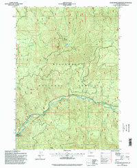
1997 Map of Huckleberry Mountain
USGS Topo · Published 1998About this map
Huckleberry Mountain and the deep drainage of the Salmon Creek watershed dominate this late-twentieth-century landscape in the Willamette National Forest. The map reflects a region defined by complex hydrology and high-elevation landforms, from the prominent Bunchgrass Ridge in the south to the secluded waters of Mehaloose Lake and Huckleberry Lake near the summit of the central massif. The presence of a lookout on the mountain and a gaging station near Salmon Creek Falls suggests the area's importance for forest management and water resource monitoring. Numerous smaller tributaries, including Wall Creek and Trapper Creek, feed into the primary river system, while several quarries indicate localized resource extraction within the forest boundaries. This survey provides a clear view of the wilderness infrastructure of the 1990s, recording the primitive roads and trails that navigate the steep terrain of Devils Canyon and Eagle Butte.
Find a feature on this map
42 named features on this map. Tap any name to fly to it.
Don’t see what you’re looking for? This feature index may not catch every label — zoom into the map to look around manually.
Map Details
Editions of this 1997 Huckleberry Mountain Map
This is the sole edition of this map. No revisions or reprints were ever made.
Other maps of this area

1925 · Waldo Lake
USGS Topo · 1:125,000

1955 · Chucksney Mtn
USGS Topo · 1:62,500

1956 · Waldo Lake
USGS Topo · 1:62,500

1956 · Oakridge
USGS Topo · 1:62,500

1956 · Sardine Butte
USGS Topo · 1:62,500

1958 · Roseburg
USGS Topo · 1:250,000

1959 · Roseburg
USGS Topo · 1:250,000

1983 · Oakridge
USGS Topo · 1:100,000
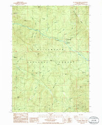
1986 · Mc Credie Springs
USGS Topo · 1:24,000
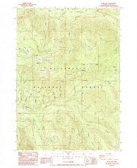
1986 · Blair Lake
USGS Topo · 1:24,000