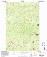
1995 Map of Huckleberry Mountain
USGS Topo · Published 1997About this map
St Joe National Forest dominates this mountain landscape, defined by a network of drainage basins and high summits. This 1990s-era topographical study records the drainage of Mica Creek as it carves through the terrain, joined by the West Fork, East Fork, and North Fork Mica Creek. High points such as Evergreen Mtn and Coddington Peak punctuate the ridges, while the namesake Huckleberry Mountain is distinguished by a permanent Lookout station at its summit. The map highlights a complex topography where the 9th Standard Parallel North cuts across several deep drainages. Beyond the peaks, the label for Meadows suggests a localized break in the timbered slopes, providing a reference point for those studying the land use and natural clearings within the Idaho forest during the late 20th century.
Find a feature on this map
24 named features on this map. Tap any name to fly to it.
Don’t see what you’re looking for? This feature index may not catch every label — zoom into the map to look around manually.
Map Details
Editions of this 1995 Huckleberry Mountain Map
This is the sole edition of this map. No revisions or reprints were ever made.
Other maps of this area

1955 · Spokane
USGS Topo · 1:250,000

1957 · Calder
USGS Topo · 1:62,500

1957 · St. Joe
USGS Topo · 1:62,500

1958 · Spokane
USGS Topo · 1:250,000

1961 · Fernwood
USGS Topo · 1:62,500

1969 · Marble Mountain
USGS Topo · 1:24,000

1969 · Grandmother Mtn
USGS Topo · 1:24,000
1969 · Merry Creek
USGS Topo · 1:24,000

1969 · Huckleberry Mtn
USGS Topo · 1:24,000

1981 · St Maries
USGS Topo · 1:100,000