
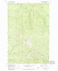
1969 Map of Grandmother Mtn
USGS Topo · Published 1973About this map
Grandmother Mtn and Grandfather Mtn anchor this high-elevation landscape within the St Joe National Forest as it was surveyed in the late 1960s. The terrain is defined by a dense network of drainage systems, including Marble Creek, Hobo Creek, and Freezeout Creek, which carve deep into the Idaho backcountry. Evidence of the region’s mineral history is visible in names like Gold Creek and Placer Creek in the southwest, suggesting the historical prospecting that once drew miners to these remote ridges.
Find a feature on this map
34 named features on this map. Tap any name to fly to it.
Don’t see what you’re looking for? This feature index may not catch every label — zoom into the map to look around manually.
Map Details
Editions of this 1969 Grandmother Mtn Map
2 editions found
Other maps of this area

1914 · Avery
USGS Topo · 1:125,000

1917 · Avery
USGS Topo · 1:125,000

1923 · Washington Creek
USGS Topo · 1:125,000

1936 · Boehls Butte
USGS Topo · 1:48,000

1943 · Boehls Butte
USGS Topo · 1:62,500

1955 · Pullman
USGS Topo · 1:250,000

1955 · Spokane
USGS Topo · 1:250,000

1956 · Wallace
USGS Topo · 1:250,000

1956 · Hamilton
USGS Topo · 1:250,000

1958 · Spokane
USGS Topo · 1:250,000