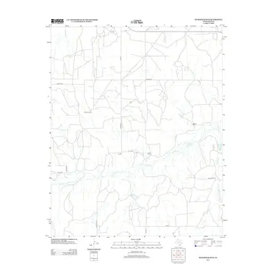
2012 Map of Hudgens Ranch
USGS Topo · Published 2012About this map
McClellan Cr meanders through the central and southern reaches of this landscape in Gray County, providing the primary drainage for a region defined by its sprawling ranchlands. This early 21st-century documentation by the U.S. Geological Survey shows a network of named properties, including the Dial-Dickey Ranch in the west and the Hudgens Ranch to the east, illustrating the persistence of large-scale landholdings in the Texas Panhandle. The infrastructure is characterized by a grid of named rural routes such as Carpenter Rd and Fish Rd, which connect these remote operations. Significant watercourses like Peterson Cr and Red Mud Cr break the high plains terrain, while specialized landmarks like the Gray Y and 4 Corners Rd provide precise navigation points within the vast pasture lands.
Find a feature on this map
20 named features on this map. Tap any name to fly to it.
Don’t see what you’re looking for? This feature index may not catch every label — zoom into the map to look around manually.
Map Details
Editions of this 2012 Hudgens Ranch Map
This is the sole edition of this map. No revisions or reprints were ever made.
Other maps of this area

1954 · Amarillo
USGS Topo · 1:250,000

1958 · Amarillo
USGS Topo · 1:250,000

1962 · Hudgens Ranch
USGS Topo · 1:24,000

1962 · Back
USGS Topo · 1:24,000

1962 · Pond Creek
USGS Topo · 1:24,000

1962 · Pond Creek NW
USGS Topo · 1:24,000

1963 · Alanreed
USGS Topo · 1:24,000

1963 · McLean
USGS Topo · 1:24,000

1964 · Rockledge
USGS Topo · 1:24,000

1967 · Lefors
USGS Topo · 1:24,000