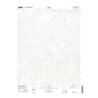
2016 Map of Hudgens Ranch
USGS Topo · Published 2016About this map
McClellan Cr meanders across this landscape in Gray County, Texas, defining the central drainage pattern as it flows eastward through the panhandle terrain. The topography is characterized by the complex drainages of Red Mud Cr and Peterson Cr, which carve through the surrounding plains. The namesake Hudgens Ranch serves as a primary local landmark, situated north of the main creek bed.
Find a feature on this map
15 named features on this map. Tap any name to fly to it.
Don’t see what you’re looking for? This feature index may not catch every label — zoom into the map to look around manually.
Map Details
Editions of this 2016 Hudgens Ranch Map
This is the sole edition of this map. No revisions or reprints were ever made.
Other maps of this area

1954 · Amarillo
USGS Topo · 1:250,000

1958 · Amarillo
USGS Topo · 1:250,000

1962 · Hudgens Ranch
USGS Topo · 1:24,000

1962 · Back
USGS Topo · 1:24,000

1962 · Pond Creek
USGS Topo · 1:24,000

1962 · Pond Creek NW
USGS Topo · 1:24,000

1963 · Alanreed
USGS Topo · 1:24,000

1963 · McLean
USGS Topo · 1:24,000

1964 · Rockledge
USGS Topo · 1:24,000

1967 · Lefors
USGS Topo · 1:24,000