
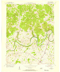
1953 Map of Hudgins
USGS Topo · Published 1954About this map
The Narrows forms a striking geographic bottleneck along the Green River as it meanders through the central Kentucky hills during the early 1950s. This survey, a collaboration involving the State of Kentucky Agricultural and Industrial Development Board, documents a landscape defined by small rural clusters and an extensive network of family cemeteries and local churches. The terrain transitions from the high elevations of Puckett Knob and Akin Knob down to the fertile river flats of Round Bottom.
Find a feature on this map
52 named features on this map. Tap any name to fly to it.
Don’t see what you’re looking for? This feature index may not catch every label — zoom into the map to look around manually.
Map Details
Editions of this 1953 Hudgins Map
This is the sole edition of this map. No revisions or reprints were ever made.
Other maps of this area

1934 · Munfordville
USGS Topo · 1:48,000

1935 · Horse Cave
USGS Topo · 1:48,000

1937 · Munfordville
USGS Topo · 1:62,500

1938 · Horse Cave
USGS Topo · 1:62,500

1953 · Hibernia
USGS Topo · 1:24,000

1953 · Summersville
USGS Topo · 1:24,000

1953 · Exie
USGS Topo · 1:24,000

1953 · Magnolia
USGS Topo · 1:24,000

1953 · Center
USGS Topo · 1:24,000
1953 · Canmer
USGS Topo · 1:24,000