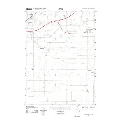
2011 Map of Hudsonville East
USGS Topo · Published 2011About this map
Hudsonville and Jamestown anchor this landscape during a period of suburban expansion into the agricultural corridors south of the Grand Rapids area. The map illustrates a transition from established rural hamlets like Gitchel and Forest Grove to a more interconnected residential network. A notable concentration of religious and genealogical sites is evident across the terrain, including the historic Shackhuddle Cemetery and the Saint Mary's Catholic Church of New Salem Cemetery near the southern border.
Find a feature on this map
70 named features on this map. Tap any name to fly to it.
Don’t see what you’re looking for? This feature index may not catch every label — zoom into the map to look around manually.
Map Details
Editions of this 2011 Hudsonville East Map
This is the sole edition of this map. No revisions or reprints were ever made.
Other maps of this area

1914 · Grand Rapids
USGS Topo · 1:62,500

1943 · Grand Rapids
USGS Topo · 1:62,500

1958 · Allendale
USGS Topo · 1:24,000

1958 · Allegan
USGS Topo · 1:62,500

1958 · Grandville
USGS Topo · 1:62,500

1958 · Grandville
USGS Topo · 1:24,000

1958 · Grand Rapids
USGS Topo · 1:250,000

1959 · Wayland
USGS Topo · 1:62,500

1961 · Grand Rapids
USGS Topo · 1:250,000

1962 · Grand Rapids
USGS Topo · 1:250,000