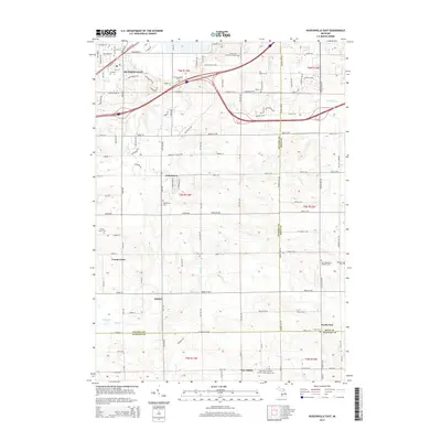
2014 Map of Hudsonville East
USGS Topo · Published 2014About this map
Hudsonville and its surrounding rural hamlets are mapped here at the intersection of Ottawa, Kent, and Allegan counties. The landscape transitions from the residential developments of the north to the agricultural fields and scattered settlements of Jamestown, Forest Grove, and New Salem further south. This region is characterized by its numerous historic burying grounds and religious landmarks, including the Saint Mary's Catholic Church of New Salem Cem and the Saint Sebastian's Catholic Cem.
Find a feature on this map
75 named features on this map. Tap any name to fly to it.
Don’t see what you’re looking for? This feature index may not catch every label — zoom into the map to look around manually.
Map Details
Editions of this 2014 Hudsonville East Map
This is the sole edition of this map. No revisions or reprints were ever made.
Other maps of this area

1914 · Grand Rapids
USGS Topo · 1:62,500

1943 · Grand Rapids
USGS Topo · 1:62,500

1958 · Allendale
USGS Topo · 1:24,000

1958 · Allegan
USGS Topo · 1:62,500

1958 · Grandville
USGS Topo · 1:62,500

1958 · Grandville
USGS Topo · 1:24,000

1958 · Grand Rapids
USGS Topo · 1:250,000

1959 · Wayland
USGS Topo · 1:62,500

1961 · Grand Rapids
USGS Topo · 1:250,000

1962 · Grand Rapids
USGS Topo · 1:250,000