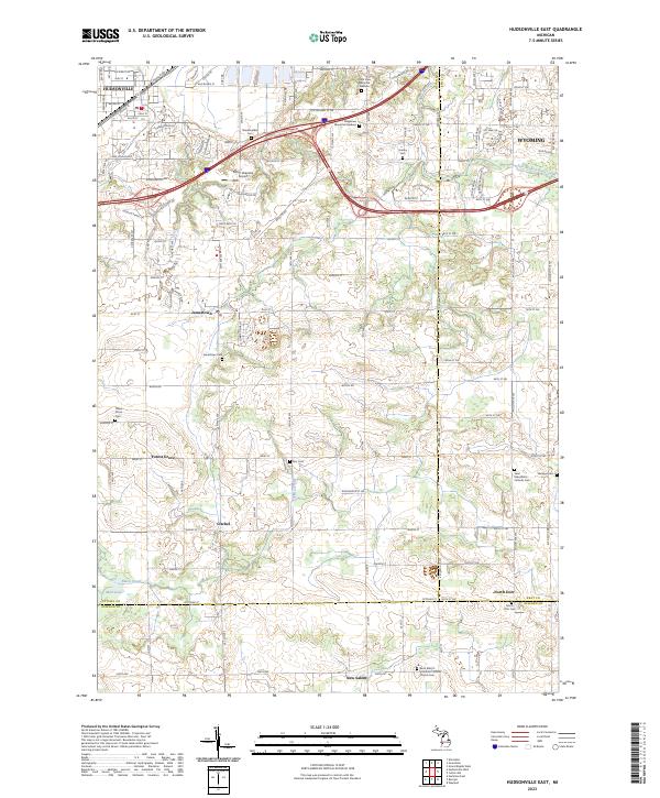
2023 Map of Hudsonville East
USGS Topo · Published 2023About this map
Hudsonville anchors this West Michigan landscape where suburban growth meets longstanding agricultural communities. The terrain is marked by a dense network of local cemeteries including Shackhuddle Cem, Hanley Cem, and Star Cem, which speak to the deep-rooted family histories of the area. Regional transit is defined by the intersection of major corridors like Chicago Dr and Van Buren St, while smaller settlements such as Jamestown, Forest Grove, and Gitchel maintain their distinct identities across the township lines. Along the southern border, the village of New Salem and the community of North Dorr sit near the triple-county junction of Ottawa, Kent, and Allegan. Notable religious landmarks, such as Saint Mary's Visitation Catholic Church and Saint Sebastian's Catholic Church, serve as focal points for these rural hamlets. The physical landscape is drained by the East Branch Rush Creek and Black Creek, which meander toward Mud Lake amidst a grid of section roads that have guided land use for generations.
Find a feature on this map
80 named features on this map. Tap any name to fly to it.
Don’t see what you’re looking for? This feature index may not catch every label — zoom into the map to look around manually.
Map Details
Editions of this 2023 Hudsonville East Map
This is the sole edition of this map. No revisions or reprints were ever made.
Other maps of this area

1914 · Grand Rapids
USGS Topo · 1:62,500

1943 · Grand Rapids
USGS Topo · 1:62,500

1958 · Allendale
USGS Topo · 1:24,000

1958 · Allegan
USGS Topo · 1:62,500

1958 · Grandville
USGS Topo · 1:62,500

1958 · Grandville
USGS Topo · 1:24,000

1958 · Grand Rapids
USGS Topo · 1:250,000

1959 · Wayland
USGS Topo · 1:62,500

1961 · Grand Rapids
USGS Topo · 1:250,000

1962 · Grand Rapids
USGS Topo · 1:250,000