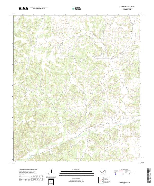
2022 Map of Hudspeth Draw
USGS Topo · Published 2022About this map
Dry Devils River snakes through the southern portion of this Sutton County landscape, defining the local drainage patterns in an area characterized by significant elevation changes and deep natural draws. The intermittent waterway is joined by Hudspeth Draw and Sawyer Draw, which carve through the terrain to create a complex network of ridges and valleys. While the land remains largely open, a sparse network of private and county roads, such as Aldwell Rd and Co Rd 405, provides the primary access to the various ranch properties that occupy the plateaus between the draws. The prevalence of these named topographical features, including Halbert Draw in the northeast, underscores the importance of water management and natural boundaries in this part of the Texas Hill Country.
Find a feature on this map
11 named features on this map. Tap any name to fly to it.
Don’t see what you’re looking for? This feature index may not catch every label — zoom into the map to look around manually.
Map Details
Editions of this 2022 Hudspeth Draw Map
This is the sole edition of this map. No revisions or reprints were ever made.
Other maps of this area

1954 · Sonora
USGS Topo · 1:250,000

1958 · Sonora
USGS Topo · 1:250,000

1964 · Sonora
USGS Topo · 1:24,000

1967 · Dunbar Draw SW
USGS Topo · 1:24,000

1967 · Flat Rock Draw SE
USGS Topo · 1:24,000

1967 · Dunbar Draw NW
USGS Topo · 1:24,000

1967 · Flat Rock Draw SW
USGS Topo · 1:24,000

1967 · Shafter Draw
USGS Topo · 1:24,000

1967 · Hudspeth Draw
USGS Topo · 1:24,000

1967 · Caverns Of Sonora
USGS Topo · 1:24,000