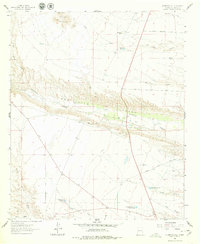
1961 Map of Huerfano Hill
USGS Topo · Published 1979About this map
Huerfano Hill stands as a prominent landmark in this 1961 field-checked survey of Sierra County, where the high desert landscape is deeply incised by Alamosa Creek and Monticello Canyon. The map reveals a remote ranching environment defined by essential water management, including several tanks and small reservoirs like the M N Chavez Res No 1 and the Cuchillo Community Allotment Res. To the north, the terrain rises toward the Sierras Mediano and is carved by drainage systems like Aragon Wash. This geography dictated a sparse network of travel, consisting primarily of specialized routes like the Lower Narrows Road and the Monticello Point Road. The presence of the Gravel Pit near Pinosa Canyon suggests localized industrial activity, while numerous family-named landmarks like Samora Draw and Martin Ranch Road provide valuable geographic clues for regional history researchers.
Find a feature on this map
23 named features on this map. Tap any name to fly to it.
Don’t see what you’re looking for? This feature index may not catch every label — zoom into the map to look around manually.
Map Details
Editions of this 1961 Huerfano Hill Map
3 editions found
Other maps of this area

1954 · Tularosa
USGS Topo · 1:250,000

1958 · Tularosa
USGS Topo · 1:250,000

1958 · Elephant Butte
USGS Topo · 1:24,000

1959 · Engle
USGS Topo · 1:62,500

1961 · Priest Tank
USGS Topo · 1:24,000

1961 · Huerfano Hill
USGS Topo · 1:24,000

1961 · Sierra Fijardo
USGS Topo · 1:24,000

1961 · Black Bluffs
USGS Topo · 1:24,000

1961 · Williamsburg NW
USGS Topo · 1:24,000

1961 · Monticello
USGS Topo · 1:24,000