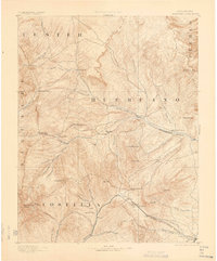
1892 Map of Huerfano Park
USGS Topo · Published 1900About this map
Huerfano River drainage dominates this high-altitude landscape, where early settlement was dictated by mountain passes and the arrival of the rail. In the late 19th century, the Denver and Rio Grande Railroad carved a vital route through the southern reaches, connecting the village of La Veta to the mining and ranching interests via Veta Pass. Small outposts like Malachite, Gardner, and Sharpsdale served as remote hubs for those navigating the eastern slopes of the Sangre de Cristo Mountains.
Find a feature on this map
60 named features on this map. Tap any name to fly to it.
Don’t see what you’re looking for? This feature index may not catch every label — zoom into the map to look around manually.
Map Details
Editions of this 1892 Huerfano Park Map
5 editions found
Other maps of this area

1889 · Canon City
USGS Topo · 1:125,000

1889 · Huerfano Park
USGS Topo · 1:125,000

1891 · Walsenburg
USGS Topo · 1:125,000

1891 · Pueblo
USGS Topo · 1:125,000

1891 · Spanish Peaks
USGS Topo · 1:125,000

1892 · Huerfano Park
USGS Topo · 1:125,000

1892 · Canon City
USGS Topo · 1:125,000

1893 · Spanish Peaks
USGS Topo · 1:125,000

1894 · Walsenburg
USGS Topo · 1:125,000

1894 · Pueblo
USGS Topo · 1:125,000