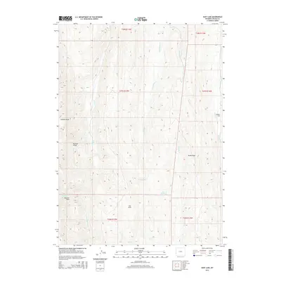
2015 Map of Huff Lake
USGS Topo · Published 2015About this map
Sublette Range topography dominates this section of the Wyoming-Lincoln County border, characterized by a complex drainage system feeding the Smiths Fork. The high-altitude terrain is defined by prominent landmarks such as Pine Knoll and the sweeping Muddy Ridge, which separates numerous seasonal and perennial watercourses. Hydrological features are central to this landscape, including the eponymous Huff Lake and the managed waters of the Fourth Cr Reservoir. This 2015 survey illustrates the remote character of the region, where the land is primarily organized by natural basins like the Raymond Basin and deep incisions such as Raymond Canyon. The map provides a detailed view of the watershed transitions between Little Muddy Cr, Muddy Cr, and Bourne Cr as they navigate the varying elevations of Collett Flat.
Find a feature on this map
25 named features on this map. Tap any name to fly to it.
Don’t see what you’re looking for? This feature index may not catch every label — zoom into the map to look around manually.
Map Details
Editions of this 2015 Huff Lake Map
This is the sole edition of this map. No revisions or reprints were ever made.
Other maps of this area

1909 · Montpelier
USGS Topo · 1:125,000

1911 · Montpelier
USGS Topo · 1:125,000

1936 · Cokeville
USGS Topo · 1:96,000

1942 · Cokeville
USGS Topo · 1:125,000

1955 · Preston
USGS Topo · 1:250,000

1958 · Preston
USGS Topo · 1:250,000

1962 · Preston
USGS Topo · 1:250,000

1967 · Big Park
USGS Topo · 1:24,000

1967 · Huff Lake
USGS Topo · 1:24,000

1967 · Porcupine Creek
USGS Topo · 1:24,000