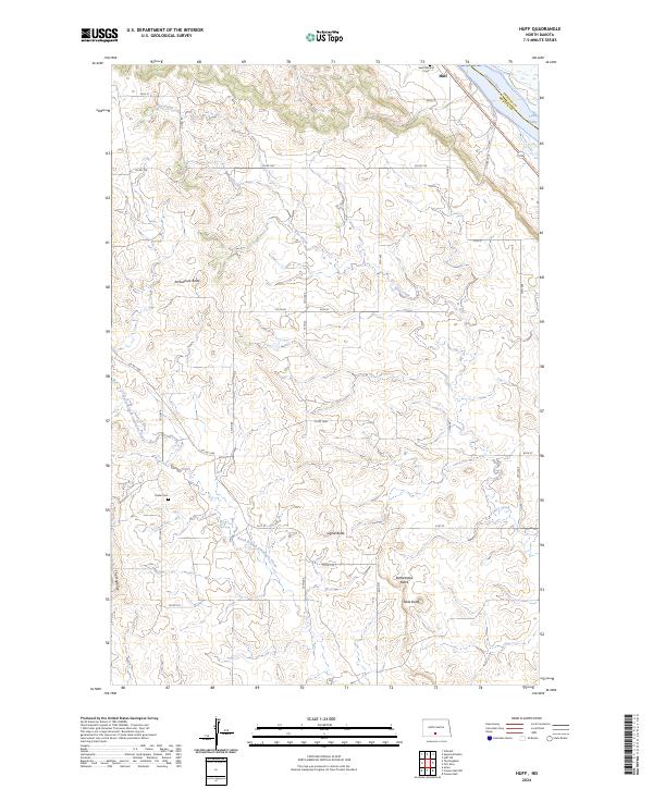
2024 Map of Huff
USGS Topo · Published 2024About this map
The Missouri River flows along the northeastern boundary of this Morton County landscape, where the waters of Lake Oahe meet the river's edge. The settlement of Huff sits near the riverbank, serving as a focal point for a region defined by distinct topographical rises and coulees. High points such as Ambulance Butte, Signal Butte, and Rattlesnake Butte provide significant vertical relief against the surrounding plains, while The Hogback runs along the western portion of the quadrangle.
Find a feature on this map
28 named features on this map. Tap any name to fly to it.
Don’t see what you’re looking for? This feature index may not catch every label — zoom into the map to look around manually.
Map Details
Editions of this 2024 Huff Map
This is the sole edition of this map. No revisions or reprints were ever made.
Other maps of this area

1907 · Bismarck
USGS Topo · 1:125,000

1954 · Bismarck
USGS Topo · 1:250,000

1958 · Bismarck
USGS Topo · 1:250,000

1962 · Sugarloaf Butte
USGS Topo · 1:24,000

1962 · Schmidt
USGS Topo · 1:24,000

1968 · Cannon Ball
USGS Topo · 1:24,000

1968 · Cannon Ball NW
USGS Topo · 1:24,000

1971 · Huff
USGS Topo · 1:24,000

1971 · Fort Rice
USGS Topo · 1:24,000

1971 · Huff NE
USGS Topo · 1:24,000