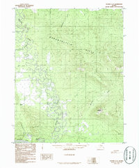
1986 Map of Hughes A-5
USGS Topo · Published 1986About this map
Hog Landing sits along the southern edge of this interior landscape, marking a small human footprint where the Koyukuk River and Hogatzakhatak Creek meet. This 1980s survey illustrates a region defined by the expansive Koyukuk National Wildlife Refuge, where the braided channel of the Hogatza River snakes through low-lying wetlands and complex river bends.
Find a feature on this map
12 named features on this map. Tap any name to fly to it.
Don’t see what you’re looking for? This feature index may not catch every label — zoom into the map to look around manually.
Map Details
Editions of this 1986 Hughes A-5 Map
This is the sole edition of this map. No revisions or reprints were ever made.
Other maps of this area

1951 · Hughes
USGS Topo · 1:250,000

1951 · Melozitna
USGS Topo · 1:250,000

1954 · Melozitna D-5
USGS Topo · 1:63,360

1954 · Melozitna D-4
USGS Topo · 1:63,360

1954 · Melozitna D-6
USGS Topo · 1:63,360

1956 · Hughes
USGS Topo · 1:250,000

1956 · Melozitna
USGS Topo · 1:250,000

1964 · Hughes
USGS Topo · 1:250,000

1965 · Hughes
USGS Topo · 1:250,000
1986 · Hughes A-6
USGS Topo · 1:63,360