
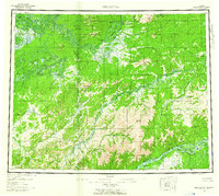
1956 Map of Melozitna
USGS Topo · Published 1961About this map
Twelvemile Fishing Camp and Birches Native Fishing Camp anchor this interior Alaskan landscape, highlighting the seasonal subsistence patterns along the major river systems of the mid-1950s. The great Yukon River flows across the southern portion of the sheet, joined by sloughs and islands like Huggins Island and Treat Island. Further north, the Koyukuk River and Indian River wind through a complex topography of ridges and peaks, including the Kokrines Hills and the Isahultila Mountains.
Find a feature on this map
62 named features on this map. Tap any name to fly to it.
Don’t see what you’re looking for? This feature index may not catch every label — zoom into the map to look around manually.
Map Details
Editions of this 1956 Melozitna Map
5 editions found
Other maps of this area

1945 · Nulato
USGS Topo · 1:250,000

1948 · Kantishna River
USGS Topo · 1:250,000

1951 · Shungnak
USGS Topo · 1:250,000

1951 · Nulato
USGS Topo · 1:250,000

1951 · Kantishna River
USGS Topo · 1:250,000

1951 · Ruby
USGS Topo · 1:250,000

1951 · Kateel River
USGS Topo · 1:250,000

1951 · Hughes
USGS Topo · 1:250,000

1951 · Melozitna
USGS Topo · 1:250,000

1951 · Bettles
USGS Topo · 1:250,000