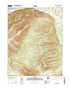
2016 Map of Hughes B-1 SW
USGS Topo · Published 2016About this map
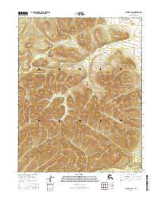
Kohokachalla Mtn dominates the northern interior of this landscape, rising above the winding course of the Koyukuk River. The terrain is defined by the complex hydrology of the river's floodplain, where features like Curve Slough and Dog Island mark the shifting patterns of the water over time. These alluvial formations indicate a highly dynamic environment where the river frequently alters its path, leaving behind oxbows and islands that shape local navigation and land use. In the southern reaches of the map, the drainage of Slathtouka Cr carves through the lower elevations, illustrating the watershed connectivity of the Yukon-Koyukuk region. This 2016 survey provides a precise record of these landforms and water systems, which are essential for understanding the remote wilderness and traditional waterways of interior Alaska.
Find a feature on this map
9 named features on this map. Tap any name to fly to it.
Don’t see what you’re looking for? This feature index may not catch every label — zoom into the map to look around manually.
Map Details
Editions of this 2016 Hughes B-1 SW Map
This is the sole edition of this map. No revisions or reprints were ever made.
Other maps of this area

1951 · Hughes
USGS Topo · 1:250,000

1955 · Hughes A-2
USGS Topo · 1:63,360

1955 · Hughes A-1
USGS Topo · 1:63,360

1956 · Hughes
USGS Topo · 1:250,000
1956 · Hughes A-2
USGS Topo · 1:63,360

1964 · Hughes
USGS Topo · 1:250,000

1965 · Hughes
USGS Topo · 1:250,000
1986 · Hughes B-1
USGS Topo · 1:63,360
1986 · Hughes B-2
USGS Topo · 1:63,360
2016 · Hughes B-2 NE
USGS Topo · 1:25,000