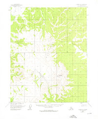
1956 Map of Hughes A-2
USGS Topo · Published 1976About this map
The Indian Mountains dominate this mid-century interior landscape, rising above a network of waterways and winter transport routes. A notable center of activity is found at the base of Indian Mountain, where a Landing Strip and Placer Mine indicate the era's reliance on bush aviation and small-scale mineral extraction in this roadless territory. The survey captures a time before modern infrastructure, where travel often relied on seasonal routes like the Sled Trail in the northwest corner.
Find a feature on this map
16 named features on this map. Tap any name to fly to it.
Don’t see what you’re looking for? This feature index may not catch every label — zoom into the map to look around manually.
Map Details
Editions of this 1956 Hughes A-2 Map
3 editions found
Other maps of this area

1951 · Hughes
USGS Topo · 1:250,000

1951 · Melozitna
USGS Topo · 1:250,000

1952 · Melozitna D-1
USGS Topo · 1:63,360

1952 · Melozitna D-3
USGS Topo · 1:63,360

1954 · Melozitna D-3
USGS Topo · 1:63,360

1955 · Melozitna D-2
USGS Topo · 1:63,360

1955 · Hughes A-2
USGS Topo · 1:63,360

1955 · Hughes A-1
USGS Topo · 1:63,360

1955 · Hughes A-3
USGS Topo · 1:63,360

1956 · Hughes
USGS Topo · 1:250,000