
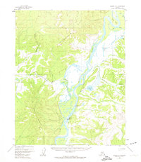
1955 Map of Hughes A-3
USGS Topo · Published 1958About this map
Hughes and its essential Landing Strip serve as the primary focus along the shifting course of the Koyukuk River in the mid-1950s. This interior Alaska landscape is defined by its seasonal transport routes, most notably the extensive Sled Trail that winds westward through the narrow Hatdolitna Canyon. The presence of a small Cabin and the Cem VABM Grave 285 reflects the sparse but established human footprint in the region during this era.
Find a feature on this map
18 named features on this map. Tap any name to fly to it.
Don’t see what you’re looking for? This feature index may not catch every label — zoom into the map to look around manually.
Map Details
Editions of this 1955 Hughes A-3 Map
This is the sole edition of this map. No revisions or reprints were ever made.
Other maps of this area

1951 · Hughes
USGS Topo · 1:250,000

1951 · Melozitna
USGS Topo · 1:250,000

1952 · Melozitna D-3
USGS Topo · 1:63,360

1954 · Melozitna D-4
USGS Topo · 1:63,360

1954 · Melozitna D-3
USGS Topo · 1:63,360

1955 · Melozitna D-2
USGS Topo · 1:63,360

1955 · Hughes A-2
USGS Topo · 1:63,360

1956 · Hughes
USGS Topo · 1:250,000

1956 · Melozitna
USGS Topo · 1:250,000
1956 · Hughes A-3
USGS Topo · 1:63,360