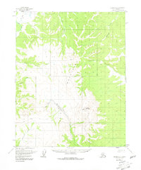
1956 Map of Hughes A-2
USGS Topo · Published 1981About this map
Indian Mountains dominate the interior of this Alaskan survey, rising sharply above the winding Indian River and its network of tributaries. The landscape reflects the remote operations of the mid-1950s, characterized by the absence of permanent towns and the presence of specialized aviation and mining outposts. At the base of the peaks, a Placer Mine and an adjacent Landing Strip indicate active resource extraction and the reliance on bush pilots for logistical support. These isolated features are linked by a primitive Sled Trail that cuts across the northern terrain, following the natural drainage of Fish Creek. The topography is defined by high ridgelines and creek valleys including Atla Creek and Slathlouka Creek, offering a detailed view of the drainage patterns and landforms in this part of the Yukon-Koyukuk region before more modern infrastructure reached the interior.
Find a feature on this map
12 named features on this map. Tap any name to fly to it.
Don’t see what you’re looking for? This feature index may not catch every label — zoom into the map to look around manually.
Map Details
Editions of this 1956 Hughes A-2 Map
3 editions found
Other maps of this area

1951 · Hughes
USGS Topo · 1:250,000

1951 · Melozitna
USGS Topo · 1:250,000

1952 · Melozitna D-1
USGS Topo · 1:63,360

1952 · Melozitna D-3
USGS Topo · 1:63,360

1954 · Melozitna D-3
USGS Topo · 1:63,360

1955 · Melozitna D-2
USGS Topo · 1:63,360

1955 · Hughes A-2
USGS Topo · 1:63,360

1955 · Hughes A-1
USGS Topo · 1:63,360

1955 · Hughes A-3
USGS Topo · 1:63,360

1956 · Hughes
USGS Topo · 1:250,000