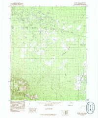
1986 Map of Hughes B-6
USGS Topo · Published 1986About this map
The Continental Divide winds through this Northwest Arctic landscape, separating the vast marshlands of the Pah River Flats from the elevated peaks of the Zane Hills. This portion of Alaska, documented in the mid-1980s, reveals a complex network of waterways including the Pah River, which meanders across the northern half of the sheet, and the Hogatza River winding through the southeastern corner. A significant point of local geographical history is noted at the Totzitigi Portage (Kobuk Portage), a traditional travel route across the divide. The terrain transitions from the low-lying basins fed by Asiksat Creek and Holly Creek to the southern ridges where Comeback Creek, Holiday Creek, and Comstock Creek originate. The map provides a clear picture of the natural drainage patterns in a region defined entirely by its wilderness features rather than human settlement.
Find a feature on this map
11 named features on this map. Tap any name to fly to it.
Don’t see what you’re looking for? This feature index may not catch every label — zoom into the map to look around manually.
Map Details
Editions of this 1986 Hughes B-6 Map
This is the sole edition of this map. No revisions or reprints were ever made.
Other maps of this area

1951 · Shungnak
USGS Topo · 1:250,000

1951 · Hughes
USGS Topo · 1:250,000

1955 · Shungnak
USGS Topo · 1:250,000

1956 · Hughes
USGS Topo · 1:250,000

1964 · Shungnak
USGS Topo · 1:250,000

1964 · Hughes
USGS Topo · 1:250,000

1965 · Hughes
USGS Topo · 1:250,000
1985 · Shungnak B-1
USGS Topo · 1:63,360
1985 · Shungnak A-1
USGS Topo · 1:63,360
1985 · Shungnak C-1
USGS Topo · 1:63,360