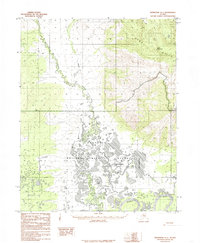
1985 Map of Shungnak A-1
USGS Topo · Published 1985About this map
Koyukuk National Wildlife Refuge dominates the lowlands of this 1985 survey, where the Koyukuk River and Dakli River converge in a complex network of wetlands and oxbow lakes. The aquatic landscape is defined by large bodies of water such as Tsbantotloden Lake, Solsmonket Lake, and Duck Lake. This region of the Yukon-Koyukuk Census Area transitions sharply from the saturated river basin to the elevated terrain of the Zane Hills in the northeast, anchored by the prominent Cone Mountain.
Find a feature on this map
11 named features on this map. Tap any name to fly to it.
Don’t see what you’re looking for? This feature index may not catch every label — zoom into the map to look around manually.
Map Details
Editions of this 1985 Shungnak A-1 Map
This is the sole edition of this map. No revisions or reprints were ever made.
Other maps of this area

1951 · Shungnak
USGS Topo · 1:250,000

1951 · Kateel River
USGS Topo · 1:250,000

1951 · Hughes
USGS Topo · 1:250,000

1951 · Melozitna
USGS Topo · 1:250,000

1954 · Kateel River D-1
USGS Topo · 1:63,360

1954 · Melozitna D-6
USGS Topo · 1:63,360

1955 · Shungnak
USGS Topo · 1:250,000

1955 · Kateel River D-2
USGS Topo · 1:63,360

1955 · Kateel River
USGS Topo · 1:250,000

1956 · Hughes
USGS Topo · 1:250,000