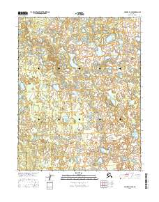
2016 Map of Hughes B-6 NW
USGS Topo · Published 2016About this map
Pah River Flats dominate this interior landscape along the border of the Northwest Arctic Borough and the Yukon-Koyukuk Census Area. This subarctic wetland system is defined by the winding course of the Pah River, which meanders across the territory alongside its tributary, Asiksat Cr. The map captures a remote section of the Alaskan wilderness where drainage patterns and water bodies are the primary geographical markers, showing the intricate network of ponds and saturated terrain that characterize the flats. Without established settlements or roads, the region’s topography is purely defined by these natural watercourses and the legal township grid lines of the Public Land Survey System.
Find a feature on this map
12 named features on this map. Tap any name to fly to it.
Don’t see what you’re looking for? This feature index may not catch every label — zoom into the map to look around manually.
Map Details
Editions of this 2016 Hughes B-6 NW Map
This is the sole edition of this map. No revisions or reprints were ever made.
Other maps of this area

1951 · Shungnak
USGS Topo · 1:250,000

1951 · Hughes
USGS Topo · 1:250,000

1955 · Shungnak
USGS Topo · 1:250,000

1956 · Hughes
USGS Topo · 1:250,000

1964 · Shungnak
USGS Topo · 1:250,000

1964 · Hughes
USGS Topo · 1:250,000

1965 · Hughes
USGS Topo · 1:250,000
1985 · Shungnak B-1
USGS Topo · 1:63,360
1985 · Shungnak C-1
USGS Topo · 1:63,360
1986 · Hughes B-6
USGS Topo · 1:63,360