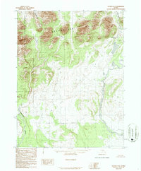
1986 Map of Hughes D-2
USGS Topo · Published 1986About this map
The Continental Divide winds through the northwest corner of this 1980s topographic record, marking a literal watershed moment in the Alaskan wilderness. This terrain is defined by the Helpmejack Hills, a series of high ridges that overlook a landscape essentially untouched by modern infrastructure. The eastern edge of the Gates of the Arctic National Preserve is established here, providing a clear boundary for one of the nation's most protected natural landscapes.
Find a feature on this map
7 named features on this map. Tap any name to fly to it.
Don’t see what you’re looking for? This feature index may not catch every label — zoom into the map to look around manually.
Map Details
Editions of this 1986 Hughes D-2 Map
This is the sole edition of this map. No revisions or reprints were ever made.
Other maps of this area

1951 · Hughes
USGS Topo · 1:250,000

1951 · Survey Pass
USGS Topo · 1:250,000

1956 · Hughes
USGS Topo · 1:250,000

1956 · Survey Pass
USGS Topo · 1:250,000

1964 · Survey Pass
USGS Topo · 1:250,000

1964 · Hughes
USGS Topo · 1:250,000

1965 · Hughes
USGS Topo · 1:250,000

1966 · Survey Pass
USGS Topo · 1:250,000
1986 · Hughes D-1
USGS Topo · 1:63,360
1986 · Survey Pass A-1
USGS Topo · 1:63,360