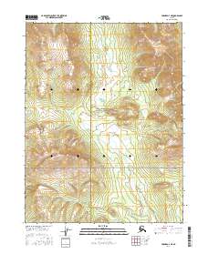
2016 Map of Hughes D-3 NE
USGS Topo · Published 2016About this map
The Continental Divide traverses the southern reaches of this landscape, marking a significant hydrologic boundary in the remote Alaskan interior. The northern half of this territory is largely defined by the protected wilderness of the Gates Of The Arctic National Preserve, where the terrain rises toward the elevations of the Helpmejack Hills. Winding through the central and southern valleys, the Hogatza River creates a drainage system that separates the high ridges. This 2016 survey also captures the administrative boundary between the Northwest Arctic Borough and the Yukon-Koyukuk Census Area, providing a precise look at how these modern geopolitical lines intersect with the natural topography of the Brooks Range foothills.
Find a feature on this map
11 named features on this map. Tap any name to fly to it.
Don’t see what you’re looking for? This feature index may not catch every label — zoom into the map to look around manually.
Map Details
Editions of this 2016 Hughes D-3 NE Map
This is the sole edition of this map. No revisions or reprints were ever made.
Other maps of this area

1951 · Hughes
USGS Topo · 1:250,000

1951 · Survey Pass
USGS Topo · 1:250,000

1956 · Hughes
USGS Topo · 1:250,000

1956 · Survey Pass
USGS Topo · 1:250,000

1964 · Survey Pass
USGS Topo · 1:250,000

1964 · Hughes
USGS Topo · 1:250,000

1965 · Hughes
USGS Topo · 1:250,000

1966 · Survey Pass
USGS Topo · 1:250,000
1986 · Survey Pass A-3
USGS Topo · 1:63,360
1986 · Hughes D-3
USGS Topo · 1:63,360