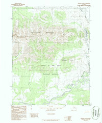
1986 Map of Hughes D-5
USGS Topo · Published 1986About this map
The Kobuk River flows through the southern reaches of this wilderness, a critical waterway for the region's hydrography and navigation. Much of the landscape is protected within the Gates Of The Artic National Preserve, a vast area defined by significant elevation changes from the valley floors to the heights of the Angayucham Mountains. The map reflects a landscape in the mid-1980s that remains largely roadless, with drainage patterns dictated by features like Beaver Creek and the isolated Lake Minakokosa. To the east, the Nilunorat Hills provide further topographical relief, while numerous smaller watercourses such as Akpelik Creek and Sulakpoatakuik Creek feed the larger river systems. This survey, compiled from aerial photography, captures the intricate network of wetlands and tributaries that define the interior of northwest Alaska.
Find a feature on this map
15 named features on this map. Tap any name to fly to it.
Don’t see what you’re looking for? This feature index may not catch every label — zoom into the map to look around manually.
Map Details
Editions of this 1986 Hughes D-5 Map
This is the sole edition of this map. No revisions or reprints were ever made.
Other maps of this area

1951 · Hughes
USGS Topo · 1:250,000

1951 · Survey Pass
USGS Topo · 1:250,000

1956 · Hughes
USGS Topo · 1:250,000

1956 · Survey Pass
USGS Topo · 1:250,000

1964 · Survey Pass
USGS Topo · 1:250,000

1964 · Hughes
USGS Topo · 1:250,000

1965 · Hughes
USGS Topo · 1:250,000

1966 · Survey Pass
USGS Topo · 1:250,000
1986 · Survey Pass A-5
USGS Topo · 1:63,360
1986 · Survey Pass A-4
USGS Topo · 1:63,360