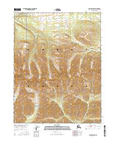
2016 Map of Hughes D-5 NW
USGS Topo · Published 2016About this map
Gates of the Arctic National Preserve covers the southern portion of this landscape, protecting a roadless wilderness within the Angayucham Mountains. The terrain is defined by steep ridges and glacial valleys, with drainage systems branching toward the south and west. The Selby River meanders through the western half of the quadrangle, flanked by numerous small ponds and wetlands in the lower elevations. To the south, Angayukachak Cr and Akpelik Cr carve through the foothills, indicating the complex hydrology of the Arctic interior. This 2016 survey reflects a region devoid of permanent settlements or infrastructure, where the natural topography remains the primary guide for navigation and land management.
Find a feature on this map
12 named features on this map. Tap any name to fly to it.
Don’t see what you’re looking for? This feature index may not catch every label — zoom into the map to look around manually.
Map Details
Editions of this 2016 Hughes D-5 NW Map
This is the sole edition of this map. No revisions or reprints were ever made.
Other maps of this area

1951 · Hughes
USGS Topo · 1:250,000

1951 · Survey Pass
USGS Topo · 1:250,000

1956 · Hughes
USGS Topo · 1:250,000

1956 · Survey Pass
USGS Topo · 1:250,000

1964 · Survey Pass
USGS Topo · 1:250,000

1964 · Hughes
USGS Topo · 1:250,000

1965 · Hughes
USGS Topo · 1:250,000

1966 · Survey Pass
USGS Topo · 1:250,000
1986 · Survey Pass A-5
USGS Topo · 1:63,360
1986 · Hughes D-5
USGS Topo · 1:63,360