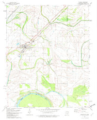
1981 Map of Hughes
USGS Topo · Published 1982About this map
Hughes stands as the central hub of this agricultural landscape in eastern Arkansas, where the town layout is defined by the intersection of rail and local transit. The 1980s terrain is heavily marked by a complex hydrological network including Fifteenmile Bayou, Caruthers Bayou, and Crooked Bayou, reflecting the intricate drainage patterns of the Delta. Small rural communities and named clusters like Penjur, North Hughes, and Belle Meade are scattered across the quadrangle, connected by a grid of farm-to-market roads. Significant local landmarks such as St Johns Ch, Sweet Home Ch, and St Marys Cem provide vital touchstones for genealogists and local historians studying the social fabric of the era. To the south, the landscape transitions toward the Arkansas Mississippi state line, bordered by Midway Lake and Goose Lake, where the levees and sloughs dictate the limits of cultivation and transport.
Find a feature on this map
30 named features on this map. Tap any name to fly to it.
Don’t see what you’re looking for? This feature index may not catch every label — zoom into the map to look around manually.
Map Details
Editions of this 1981 Hughes Map
2 editions found
Other maps of this area

1931 · Horseshoe Lake
USGS Topo · 1:62,500

1939 · Horseshoe Lake
USGS Topo · 1:62,500

1939 · Park Place
USGS Topo · 1:62,500

1939 · Edmondson
USGS Topo · 1:62,500

1940 · Whitmore
USGS Topo · 1:62,500

1948 · Helena
USGS Topo · 1:250,000

1950 · Helena
USGS Topo · 1:250,000

1953 · Memphis
USGS Topo · 1:250,000

1954 · Horseshoe Lake
USGS Topo · 1:62,500

1954 · Edmondson
USGS Topo · 1:62,500