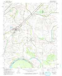
1981 Map of Hughes
USGS Topo · Published 1993About this map
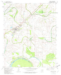
The town of Hughes anchors this landscape in the early 1980s, serving as a hub for the agricultural lands and winding waterways of the Mississippi Delta region. The town is flanked by smaller settlements like North Hughes and Penjur to the north, while the Hughes Landing Strip suggests the importance of aerial crop dusting and transport to this rural economy. The geography is dominated by a complex network of bayous and oxbow lakes, including Fifteenmile Bayou, Crooked Bayou, and Taylor Lake, which illustrate the ancient migrations of the nearby river systems. Along the southern boundary, the map captures a significant stretch of the Arkansas Mississippi state line, where Midway Lake and Bledsoe Landing mark the edge of the floodplain. Local history is preserved in sites like St Johns Ch and St Marys Cem, providing touchpoints for genealogists and researchers interested in the settlement patterns of St. Francis and Lee counties.
Find a feature on this map
32 named features on this map. Tap any name to fly to it.
Don’t see what you’re looking for? This feature index may not catch every label — zoom into the map to look around manually.
Map Details
Editions of this 1981 Hughes Map
2 editions found
Other maps of this area

1931 · Horseshoe Lake
USGS Topo · 1:62,500

1939 · Horseshoe Lake
USGS Topo · 1:62,500

1939 · Park Place
USGS Topo · 1:62,500

1939 · Edmondson
USGS Topo · 1:62,500

1940 · Whitmore
USGS Topo · 1:62,500

1948 · Helena
USGS Topo · 1:250,000

1950 · Helena
USGS Topo · 1:250,000

1953 · Memphis
USGS Topo · 1:250,000

1954 · Horseshoe Lake
USGS Topo · 1:62,500

1954 · Edmondson
USGS Topo · 1:62,500