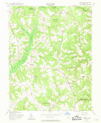
1956 Map of Hughesville
USGS Topo · Published 1969About this map
Zekiah Swamp dominates the western half of this Southern Maryland landscape, where the Zekiah Swamp Run weaves through dense wetlands and forest. The mid-century settlement patterns are centered on the crossroads at Bryantown and Hughesville, which serve as institutional hubs featuring the Notre Dame High Sch and St Marys Sch. A significant portion of the northern terrain is managed as the Cedarville State Forest, characterized by numerous watercourses like Wolf Den Br and Mudd Run.
Find a feature on this map
38 named features on this map. Tap any name to fly to it.
Don’t see what you’re looking for? This feature index may not catch every label — zoom into the map to look around manually.
Map Details
Editions of this 1956 Hughesville Map
4 editions found
Other maps of this area

1892 · Leonardtown
USGS Topo · 1:62,500

1892 · Prince Frederick
USGS Topo · 1:62,500

1892 · Brandywine
USGS Topo · 1:62,500

1894 · Wicomico
USGS Topo · 1:62,500

1895 · Prince Frederick
USGS Topo · 1:62,500

1895 · Wicomico
USGS Topo · 1:62,500

1895 · Brandywine
USGS Topo · 1:62,500

1895 · Leonardtown
USGS Topo · 1:62,500

1895 · Nomini
USGS Topo · 1:125,000

1898 · Nomini
USGS Topo · 1:125,000