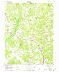
1956 Map of Hughesville
USGS Topo · Published 1977About this map
Cedarville State Forest dominates the northern reaches of this Maryland landscape, where the headwaters of the Zekiah Swamp Run and Mill Dam Run begin their drainage southward. The 1956 cultural revision, updated with 1974 aerial photogrammetry, captures the rural character of Charles County as it borders Prince George's and Saint Mary's. The inland corridor is defined by small settlements like Bryantown and Hughesville, which serve as focal points for local commerce and education, evidenced by the presence of several parochial institutions including St Marys Sch and St Peters Sch.
Find a feature on this map
46 named features on this map. Tap any name to fly to it.
Don’t see what you’re looking for? This feature index may not catch every label — zoom into the map to look around manually.
Map Details
Editions of this 1956 Hughesville Map
4 editions found
Other maps of this area

1892 · Leonardtown
USGS Topo · 1:62,500

1892 · Prince Frederick
USGS Topo · 1:62,500

1892 · Brandywine
USGS Topo · 1:62,500

1894 · Wicomico
USGS Topo · 1:62,500

1895 · Prince Frederick
USGS Topo · 1:62,500

1895 · Wicomico
USGS Topo · 1:62,500

1895 · Brandywine
USGS Topo · 1:62,500

1895 · Leonardtown
USGS Topo · 1:62,500

1895 · Nomini
USGS Topo · 1:125,000

1898 · Nomini
USGS Topo · 1:125,000