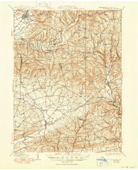
1935 Map of Hughesville
USGS Topo · Published 1950About this map
Hughesville sits at the northern edge of a landscape defined by the winding course of Muncy Creek and Little Muncy Creek during the early 1930s. This survey of the rural borderlands between Lycoming, Montour, and Columbia counties reveals a densely settled agricultural region before major post-war changes. The map is particularly notable for its exceptionally high density of rural schoolhouses, including the Steck Sch, Clayhole Sch, and California Sch, suggesting a decentralized community structure where education remained a local, neighborhood-based endeavor.
Find a feature on this map
111 named features on this map. Tap any name to fly to it.
Don’t see what you’re looking for? This feature index may not catch every label — zoom into the map to look around manually.
Map Details
Editions of this 1935 Hughesville Map

Other maps of this area

1889 · Catawissa
USGS Topo · 1:62,500

1892 · Catawissa
USGS Topo · 1:62,500

1892 · Shamokin
USGS Topo · 1:62,500

1893 · Sunbury
USGS Topo · 1:62,500

1893 · Shamokin
USGS Topo · 1:62,500

1894 · Catawissa
USGS Topo · 1:62,500

1894 · Bloomsburg
USGS Topo · 1:62,500

1924 · Milton
USGS Topo · 1:62,500

1927 · Eagles Mere
USGS Topo · 1:48,000

1930 · Warrensville
USGS Topo · 1:62,500